Paris and Beyond

Our Personal Tour de France & Other Exciting Adventures!

Archive for the category “Uncategorized”

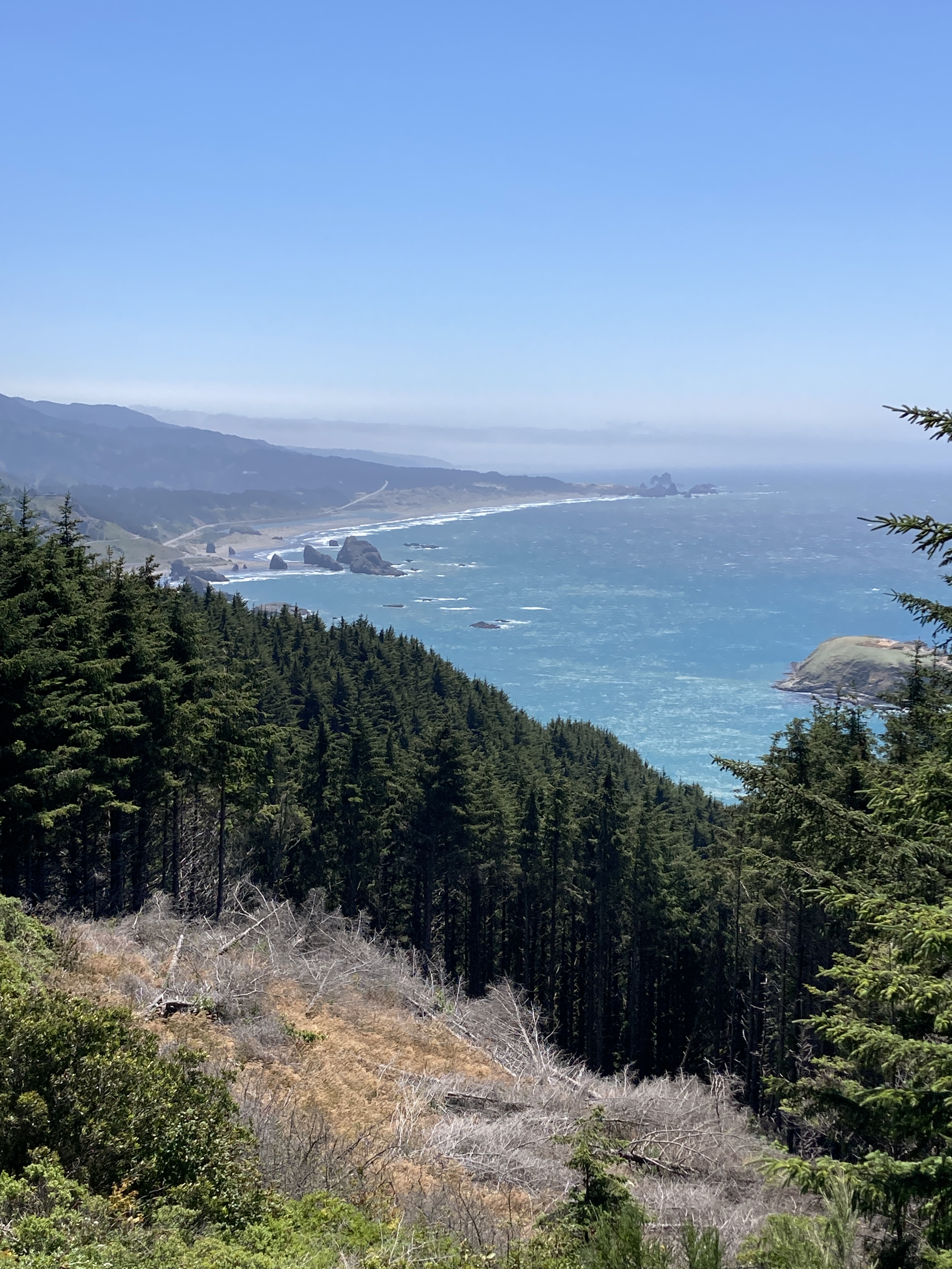
Northern Oregon Coast

Most of the places on the Oregon Coast that draw tourists and hold a true beach appeal can be found north of Florence, our easy coastal point of contact from Eugene. We have traveled that direction several times since we moved here four years ago visiting Yachats and Depoe Bay where you can find some of Oregon’s 5-star hotels such as the Whale Cove Inn and the Overleaf Lodge. We also enjoyed a stay at the Heceta Lighthouse B & B near the very scenic Cape Perpetua.

This summer, we decided to explore a little farther afield starting with Cannon Beach, the location of one of Oregon’s most familiar landmarks — Haystack Rock, a basalt sea stack that rises 235 feet above the water. The area is also renown as the setting for a number of novels, television programs, and movies such as The Goonies, Kindergarten Cop, Point Break, and Twilight. Here you will encounter a real walkable sandy beach no doubt one of the many attractions for filming.

As most of you will know, I am not a camper. I need my creature comforts, but I do like to get a taste of the outdoors. When Norman and I first got together, he was sorting out his things and trying to decide what to bring with him. He told me that he had a lot of camping gear and asked me what he should do with it. I immediately replied, “Don’t bring it here! We won’t be using it.” We’ve had a running joke for all these years that my idea of camping is staying at the Marriott. And so it is!

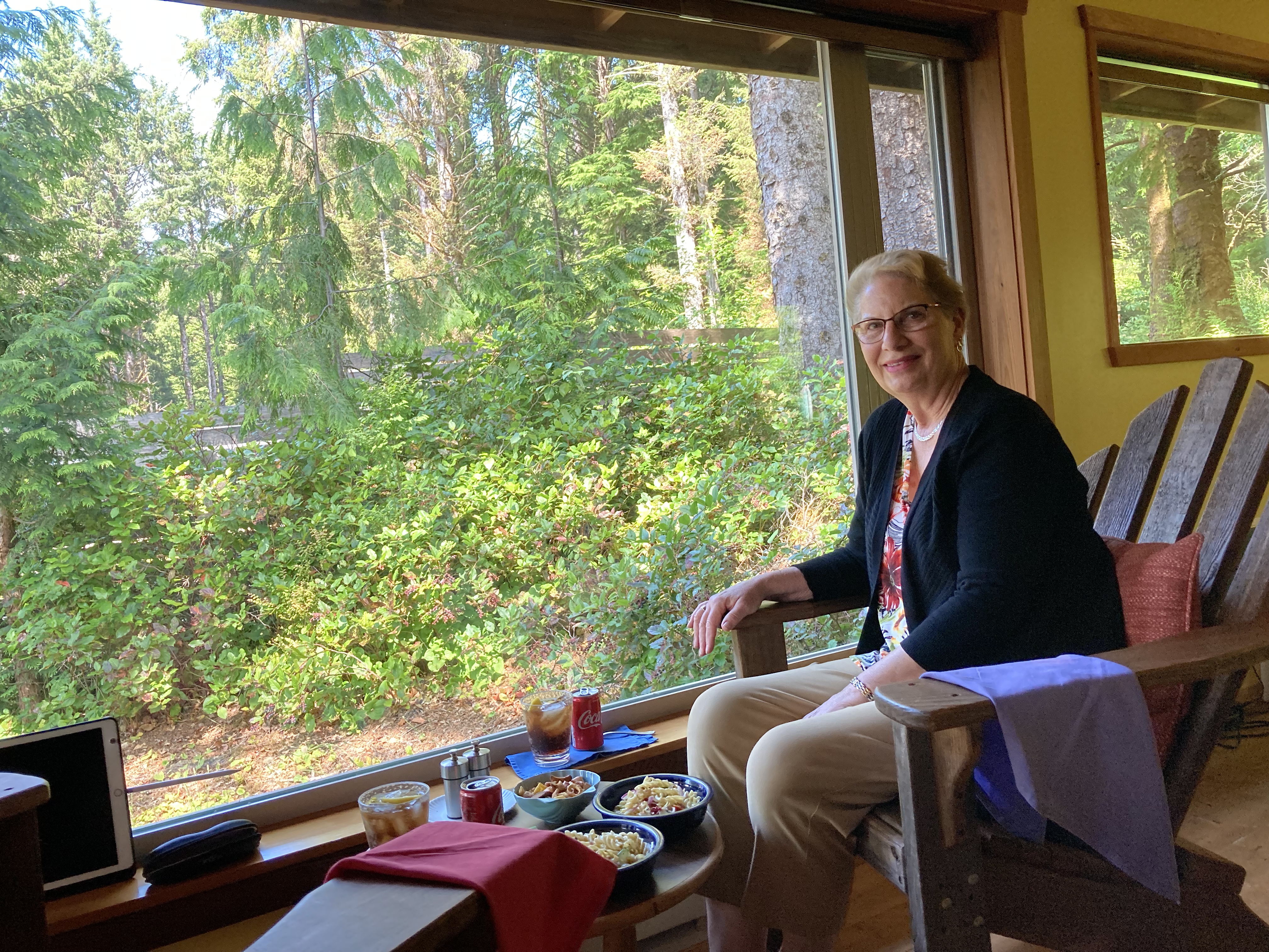
For this trip, we stayed at a small but well-appointed cabin that felt just a little bit like camping (to me anyway). Located amongst a small group of beach homes just off Highway 101 in Arch Cape, we were only a few minutes from all the places we wanted to visit. Sitting next to this picture window surrounded by huge trees for an afternoon snack was just perfect!

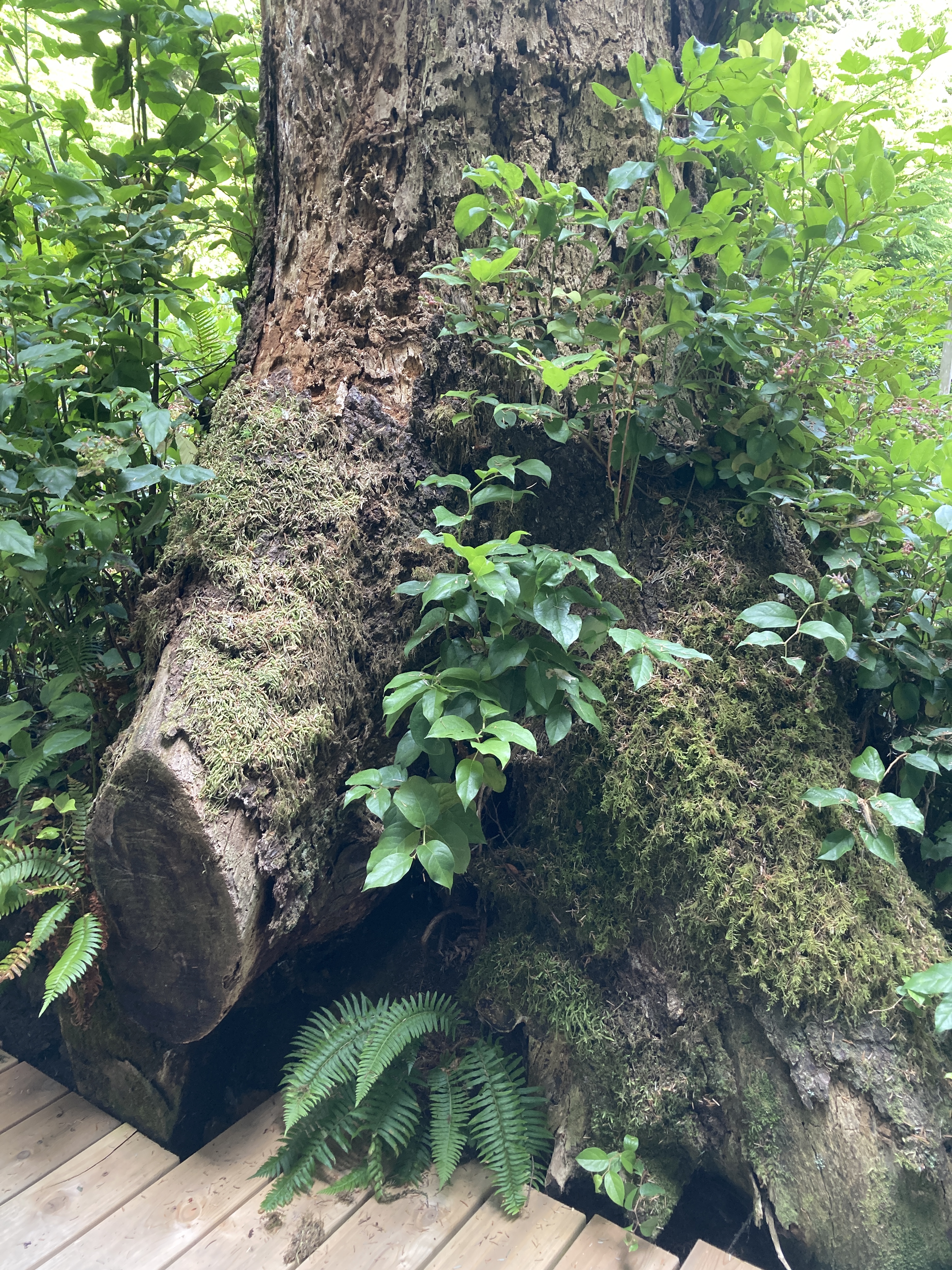
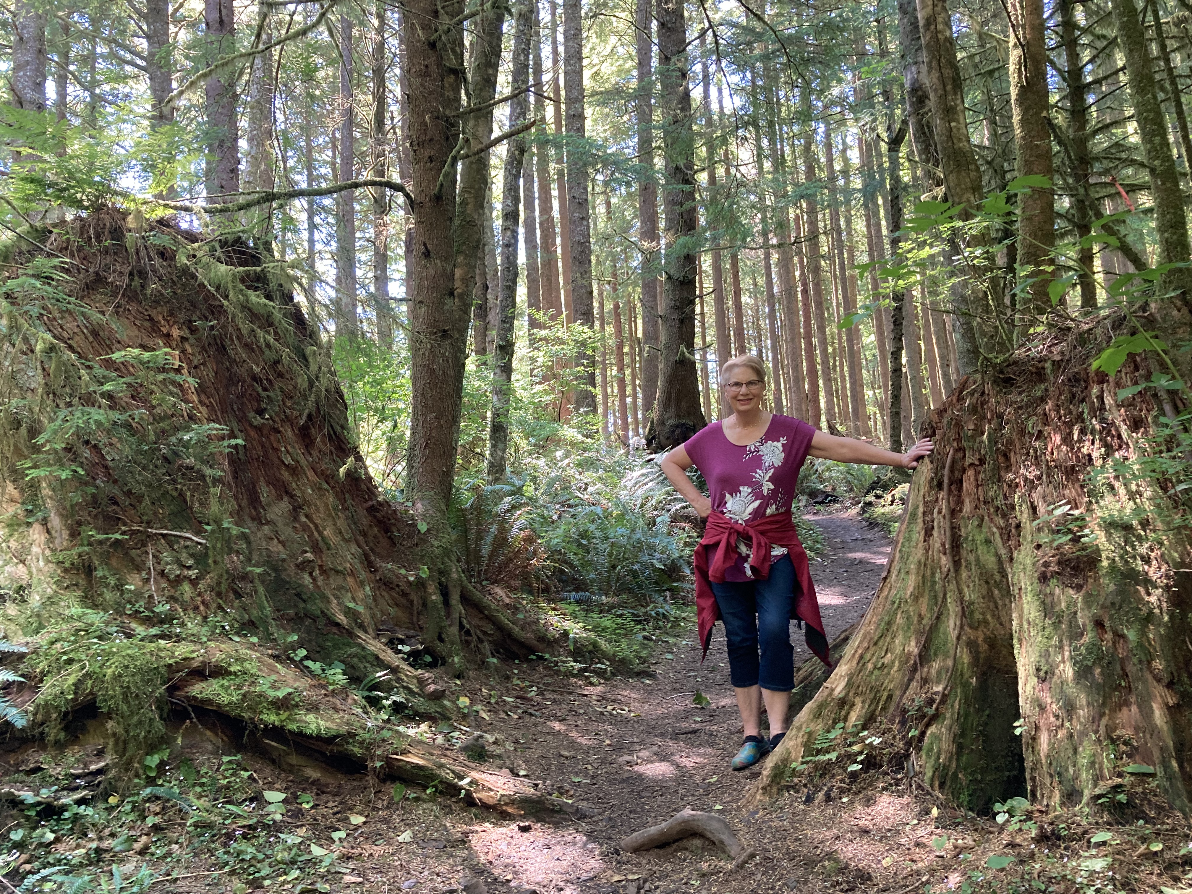
Just outside our doorway was this immense tree trunk that reminded you who or what was in charge every time you left the cabin.

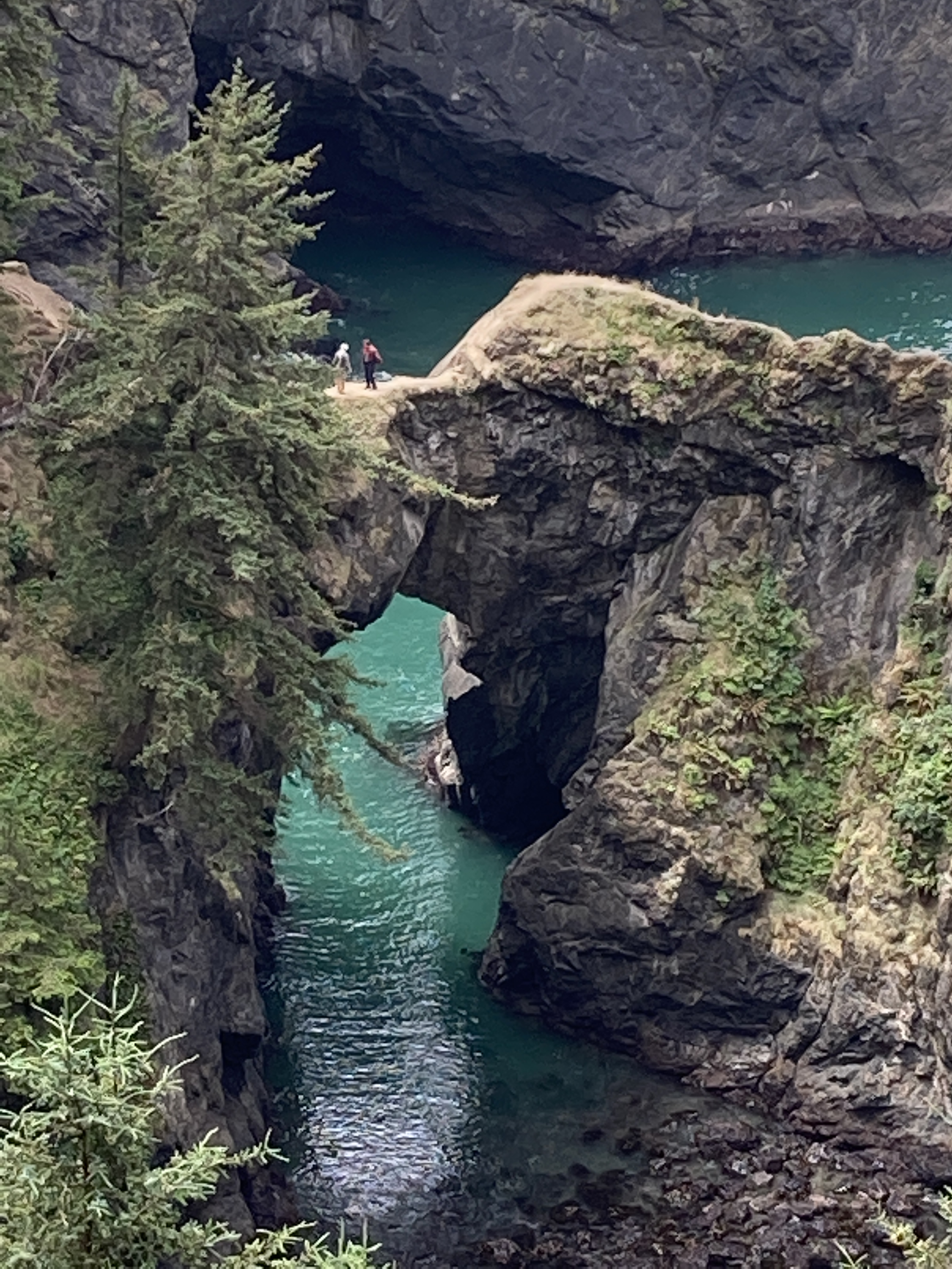
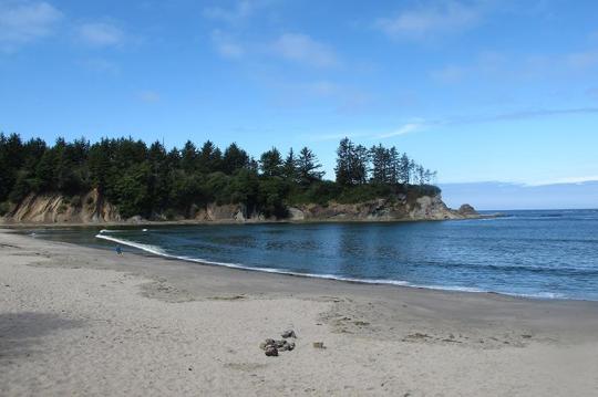
A short walk across the highway took us on a path down to the beach with a dramatic entrance. (That’s Norman walking toward the waves.)

Upon exciting this natural tunnel, we were rewarded with a pristine sunset beach scene where we watched a fleet of pelicans diving for their dinner.

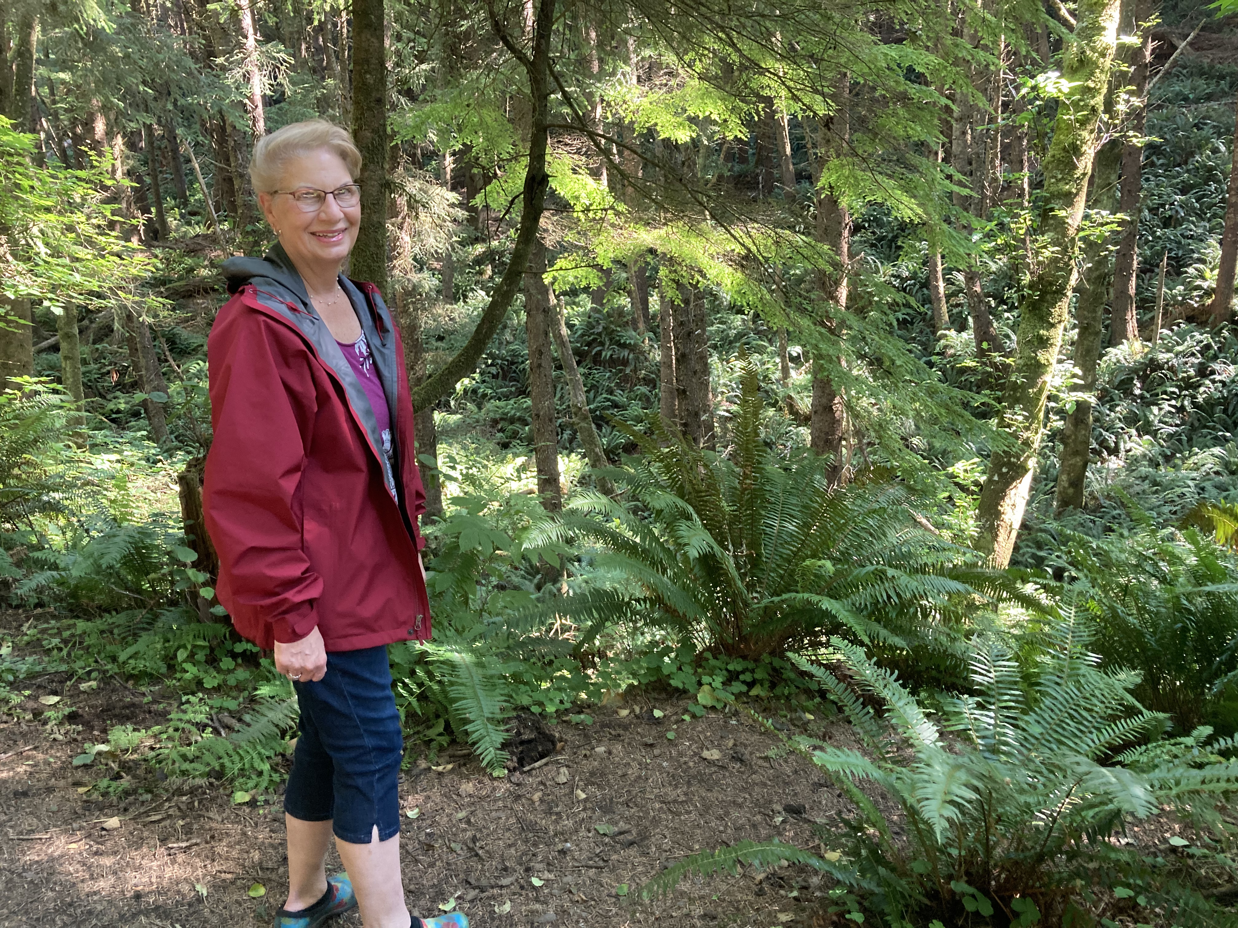
The following day, we set out for Ecola State Park which stretches along nine miles of coastline just outside Cannon Beach. I did my research (or so I thought) and found an intriguing trail I figured we could manage without too much difficulty. We parked at the Indian Beach Trailhead with a beautiful view overlooking the ocean and set off on Clatsop Loop Trail, a 2.5 mile roundtrip. Easy peasy, right? Well, we immediately found ourselves climbing up a steep hill and the incline didn’t let up until we reached the top. Turns out the elevation gain for this trail is 785 ft. Whew! No problem for Norman. I was the one struggling, but I made it! Don’t I look happy here? I had no idea what I was getting into. Ignorance is bliss perhaps?

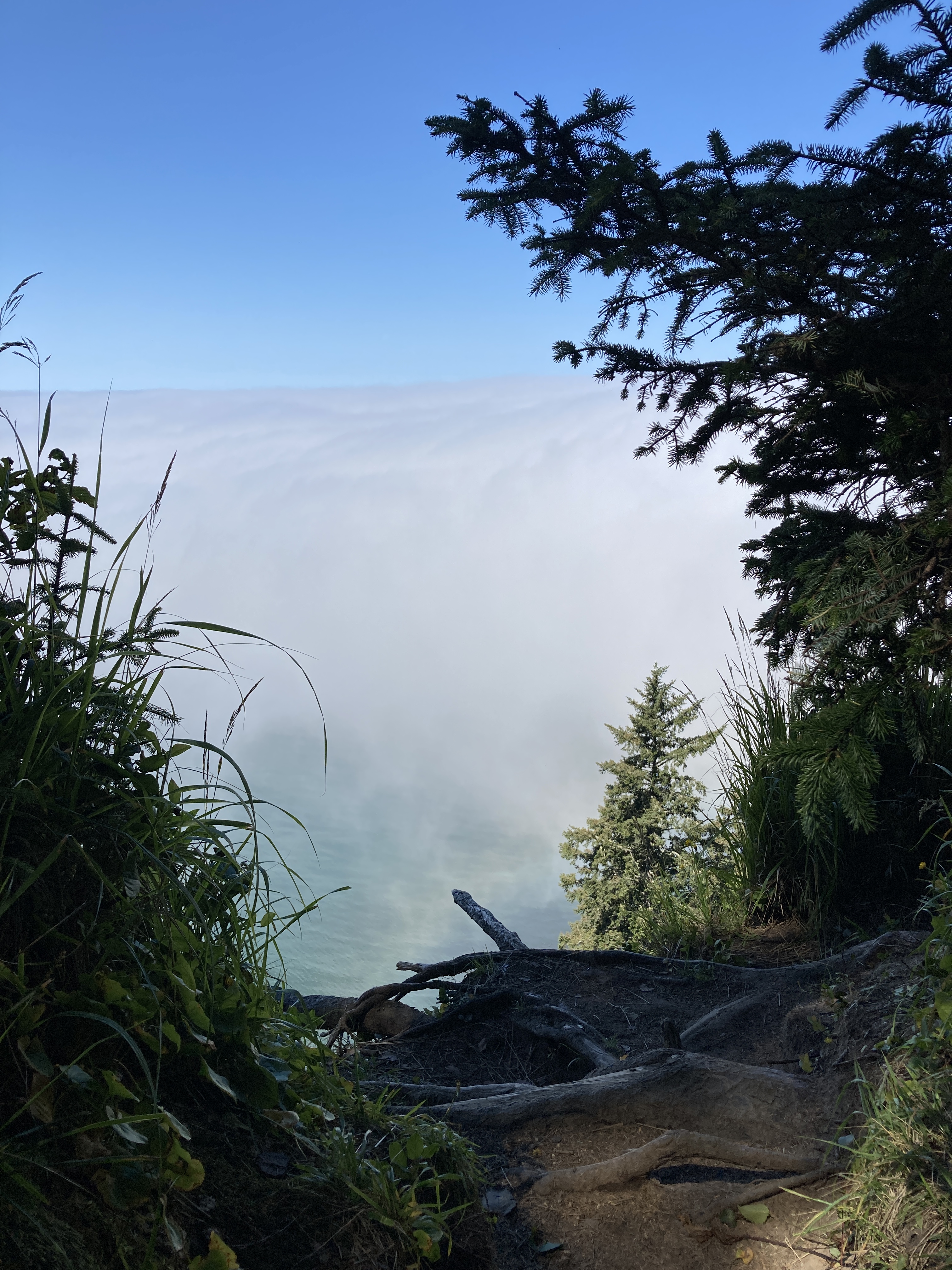
The incentive for making this climb is to get a view of “Terrible Tilly”, or the Tillamook Rock Lighthouse — the most expensive lighthouse ever constructed on the west coast. However, when we arrived at that viewpoint, this was all we were able to see. They forgot to mention that it’s often socked in with clouds or fog.

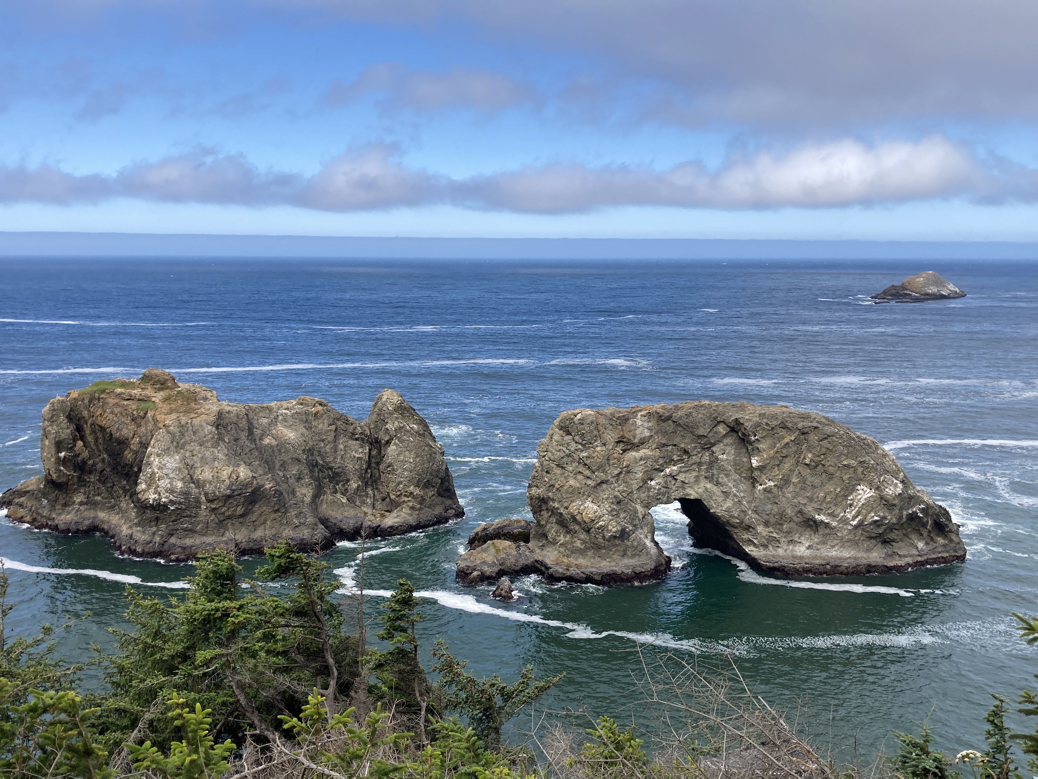
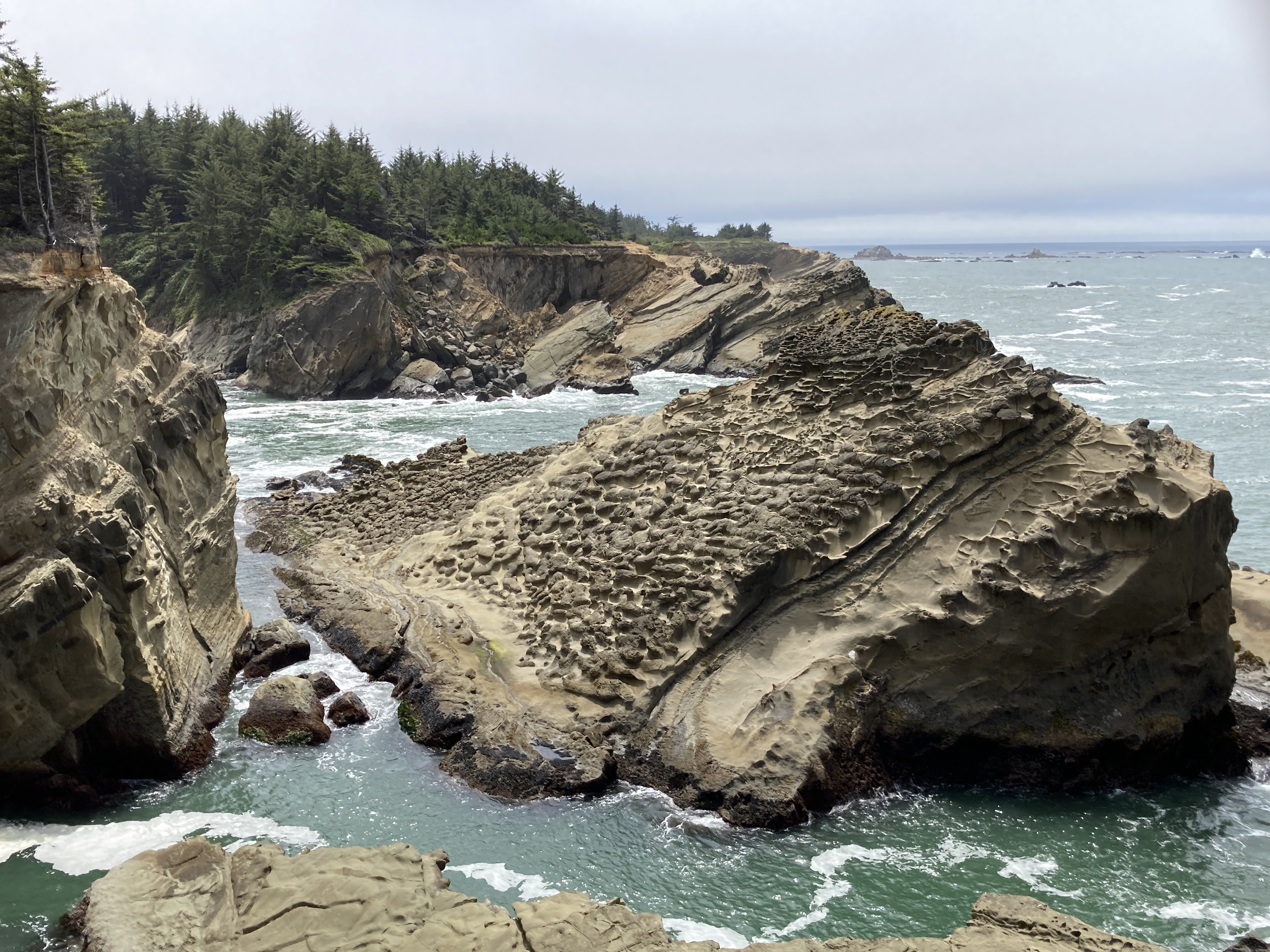
On the return, farther down the trail there are some great views of the sea stacks to the south… along the edge of one very steep cliff. You have to be careful not to lean too far to get your shot.

In the end, it was quite a challenging hike for me, but it was satisfying to know that I accomplished it. Not too bad — I’m still smiling.

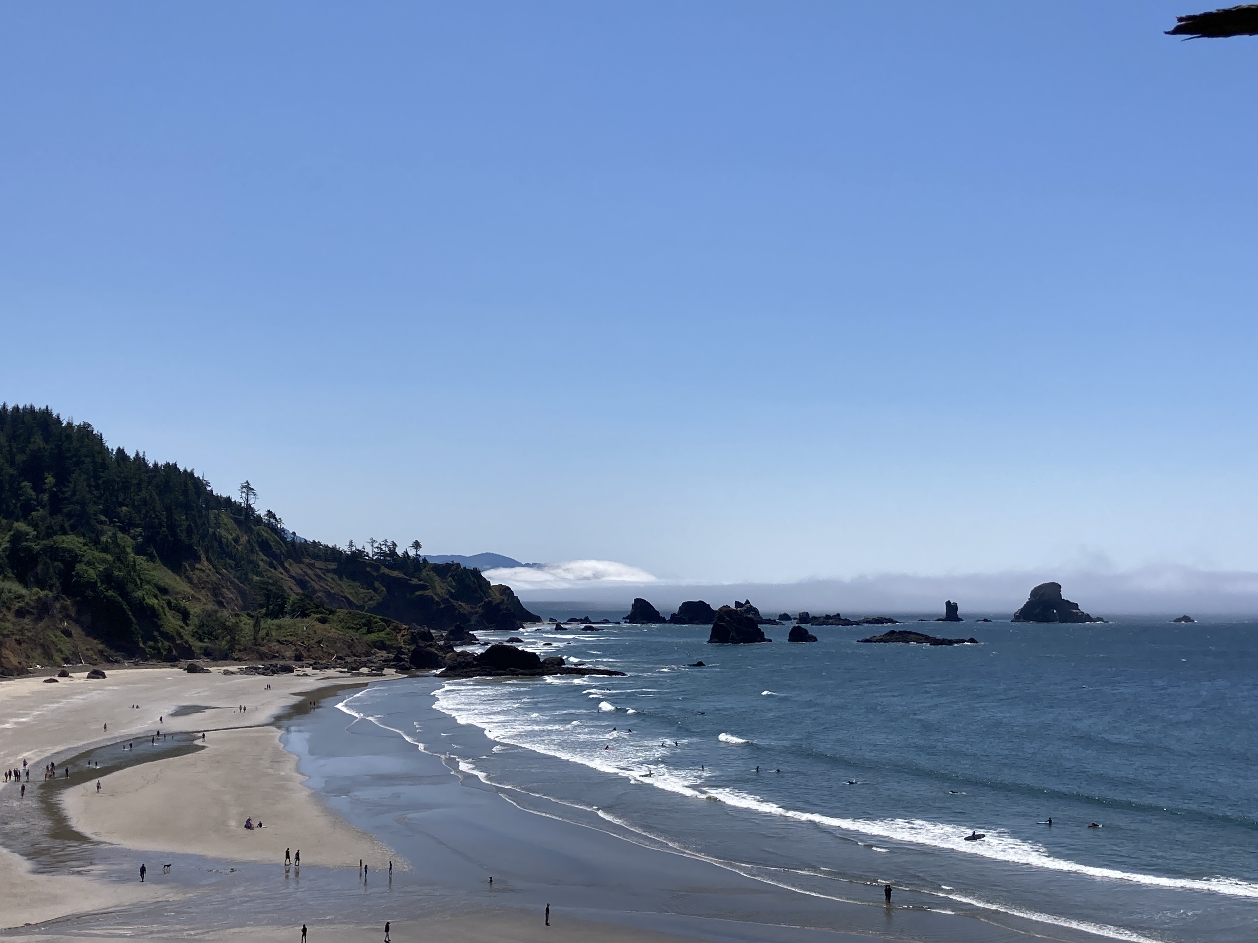
Just as you realize you have almost arrived back at the parking area experiencing some relief, you come upon a bench where you can sit and take in the splendor of Indian Beach. What a treat! A rest stop with a view. The sea stacks you see in the distance appear much larger and more impressive in reality than what any photograph reveals.

Lastly, we found a shaded picnic bench where we enjoyed a snack we had brought along and then ventured down to the beach to cool our tired feet.

This was definitely a successful Day at the Beach!

Gold Beach and Beyond

After spending some time at Shore Acres State Park, we made our way back to the 101 and continued south to Gold Beach where we stayed with our friends, Adam & Hong, for a couple of days. It was really great to catch up after so many years. One evening, we made a sunset visit to the tiny wharf of this rather tiny (pop. 2300) Oregon coastal town which sits at the confluence of the Rogue River. Despite its size, you have to admit that it’s quite photogenic. Gold Beach derives its name from the fact that hundreds of placer mines extracted gold from a nearby beach in 1853. The town holds the interesting distinction of being one of the last two remaining rural mailboat locations — delivering mail upstream since 1895 to Agness, an extremely remote community.

Sunset on Gold Beach Wharf

Aside from the ever-popular jet boat tours on the Rogue River (which we experienced way back in 2001), there is very little to do in Gold Beach. However, it makes an excellent launching pad for visiting several spectacular scenic locations farther south along the Oregon Coast. The Samuel H. Boardman State Scenic Corridor offers a multitude of landmarks to explore with craggy bluffs, secluded beaches, and offshore rock formations that can be accessed by a variety of trails. This 12-mile stretch along Highway 101 is replete with breathtaking vistas.

For those (like me) who can’t negotiate more challenging trails, there are many turnouts where you can enjoy some of the area’s beauty from the side of the road or within easy walking distance.

Arch Rock

One of the best viewpoints in the park can be found at Natural Bridges, a series of seven iconic arch rocks and blowholes. A short but very steep trail leads to a narrow bridge you can actually walk over if you are brave enough. Even though Adam has lived in Gold Beach for five spring/summer seasons, he had never had the opportunity to go there and was anxious to experience it with us. We set off on the path together, but I soon realized this was not a safe adventure for me. The trail was uneven, rocky, and potentially dangerous requiring more dexterity than I happen to possess at this point in my life. So I turned back and happily waited on the overlook platform for Adam and Norman to appear atop the bridge and eventually, they did! Norman wasn’t bothered by the height and thought it was really cool. He did have to scramble quite a bit to get there and back though. Better him than me!

Adam & Norman Conquering Natural Bridge

Cape Sebastian State Scenic Corridor affords striking panoramic views. Driving through a dense forest of Sitka spruce once you turn off the 101, you arrive at one of two expansive parking lots situated over 200 feet above sea level. Looking south, you can see almost 50 miles toward Crescent City, California… on a clear day, of course.

During this brief trip, we learned that the Southern Oregon Coast offers a myriad of opportunities to take in the wild and rugged side of nature. And it’s not far from home! Hopefully, we will return to make some other discoveries.

Next up… time to head north!

Southern Oregon Coast

Recently we discovered that some friends from our years living in the Palm Springs area of southern California had purchased a second home in Gold Beach, Oregon. They have a custom ceramics business and spend much of the year traveling to various art festivals mostly on the west coast selling their wares. To escape the heat, they decided to spend half the year in a much cooler locale. It was high time to catch up with them and take the opportunity to discover the southern Oregon Coast along the way.

We live in a rather central location in Oregon conveniently located just off the I-5 corridor. From Eugene we can easily head to the mountains, the desert, or the ocean which is just one hour and 15 minutes directly west to the city of Florence. We have ventured that direction many times. It may sound enticing, but reality is — when you get there, it’s very difficult to find the beach. You will find rocky shores or sand dunes with some effort, but no place you can really park your beach chair and soak up the sun for the day. If you have any prior beach experience i.e. California-style… you will declare, “This is NOT the beach!” You have to head north or south and even then it’s a challenge.

I was determined to find an inviting place for this southerly adventure where we could enjoy the scenery and views for a bit en route to our friends. After some research, I chose Shore Acres State Park near Coos Bay and though it was a bit off the beaten path, we were not disappointed. This property was once the estate of timber baron, Louis J. Simpson and extended to Cape Arago and Sunset Beach. The latter is now the home of Sunset Bay State Park which which we passed by on our Highway 101 “detour” to Shore Acres. We were thrilled to see that it hosts a “real” sandy beach surrounded by grassy lawns, picnic tables, and many camping opportunities… if only there were a Marriott. Nevertheless, it’s definitely a future adventure destination for us.

Sunset Bay

Shore Acres is a combination of mansion and formal gardens with rugged cliffs overlooking an ever-churning ocean. The mansion is now an observation building for those cold, blustery days (of which there are many!) when you couldn’t possibly stand outside to enjoy the view. Fortunately, we were afforded a gorgeous day. There are hiking trails in both directions along the coast offering some spectacular vistas. The unique formation of the huge rocks jutting out from beneath the waves is really intriguing.

In the formal garden area, you can enjoy a very well-maintained Japanese-style garden with a lily pond…

Such variety in plantings produces an abundance of blooms all year round. We encountered a team of gardeners who told us it’s a non-stop job taking care of this place. I can just imagine!

We loved this giant, craggy tree root that has been left along one of the trails. It immediately became a jungle gym for a group of children who arrived shortly after we did. It was delightful to see them use their imaginations to turn it into a magical playground.

The rugged geography of this location reminds me very much of Point Lobos in Monterey, California… minus those iconic Monterey Cypress of course. However, there’s plenty of other local Oregon vegetation to set off the beauty and offer a myriad of photo ops.

That’s a Beach!!

While we didn’t make it down there to that beach, it was such a pleasure exploring this area and experiencing the draw of the ocean. Peace and tranquility at its best!

Bend – Oregon’s Playground

This spring and summer we have been on a quest to become more intimately familiar with our new home state of Oregon — something we intended to do after we returned from our last trip to Europe in 2019. However, that plan was unfortunately interrupted and we had to put travel on hold for awhile. It was finally time to explore (albeit cautiously) once again and in June, we chose to travel to Bend. After Portland, Salem (the capital), and Eugene (where we live), Bend ranks 6th in population. It has experienced quite a boom in the last 20 years growing from 50,000 to over 100,000 inhabitants during this period. It may be the most popular and well-known city in Oregon due to the fact that it has developed into a veritable outdoor playground. Where people used to only frequent the area to ski in the winter, now all seasons of the year attract tourists for a variety of adventures.

Bridge over the Deschutes River in the Old Mill District.

In Bend, you can play at almost anything you can imagine and often the adventures are right downtown. It was unusually warm during our visit and many people were already taking advantage of the beautiful Deschutes River that runs through the center of the city. There were kayaks, floats, and all manner of water locomotion out and about enjoying a fairly lazy afternoon on the river. We also have a famous river running through our city, but it’s not accessible like this. We really loved the inviting atmosphere the Deschutes creates in Bend.

One unique feature created right downtown is the River Wave. So, if you’re a surfer you can get a quick fix. Apparently, this is nothing like ocean surfing and is even quite challenging for the pros. Nevertheless, they certainly make it look easy and fun!

Bend is one of only four cities in the U.S. featuring an extinct volcano within its city limits. It’s a popular hike but rather steep so we chose to drive to the top of Pilot Butte which rises to almost 500 feet. From there you get a 360-degree view of Bend and the surrounding mountains which is truly spectacular and much better in person that any photograph conveys.

In fact, there are so many huge mountains that can be seen from this point in Oregon, it’s very difficult to keep track of which one you are looking at. You are literally surrounded by dormant (you hope!) volcanoes. Mt. Washington, Mt. Jefferson, Mt. Hood, the Three Sisters — they’re all here and with the help if this compass located in the center of the viewing platform, you can pick them out. Without it, however, I just happy to see so many gorgeous snowcapped mountains.

Of course, you can’t visit Bend without taking a drive through the Deschutes National Forest to the famous Mt. Bachelor. At 9,068 feet, it is the only major volcano in the Cascades with a chairlift to the summit — open for skiing in the winter and mountain biking in the summer.

And this stellar summit is Broken Top… I think.

Last but not least, you are guaranteed to run into Sasquatch many places in Oregon and Bend is no exception. However, he can be a little intimidating!

After three days, it was time to say “Farewell Bend” (as originally named by the pioneers). On our way to Bend, we took the more northerly route passing through some of the worst devastated areas from the fires of 2019. They are still actively clearing lumber and debris as well as landslides along this highway greatly disrupting the traffic flow. Even now, it was a sad sight to see. There is still so much work to be done.

For our return trip, we decided to take the southerly route and ended up discovering a real treasure. For sometime, I had heard about the incredible beauty of Salt Creek Falls and all of a sudden we realized we were going to pass right by the entrance. We couldn’t resist the possibility of seeing one more spectacular Oregon waterfall so we made a quick detour. Was it ever worth it! We will definitely be back for a longer visit to this one with all our camera gear in tow and perhaps a fancy picnic lunch.

And… I’m sure we will visit Bend again. In fact, we already have plans for a trip to some of our favorite Oregon locales in October to enjoy the fall color and try to capture it through the lens of our DSLR. We are not exactly an outdoorsy couple (especially me), but the beauty and tranquility will bring back.

Just Can’t Get Enough

Geared up for another day in the Gorge, we headed off to Bridal Veil Falls State Park. This is my kind of park — nice parking lot, picnic tables and grassy area, plus “real” bathrooms! As most readers know, I’m not up for camping or roughing it in the outback, but I do love nature and am willing to enjoy it comfortably so this is a perfect place for me. There are two short trails available here. The first is a 2/3 mile interpretive loop that passes through wildflower meadows and camas fields with three vistas of the Columbia River. The second is a 1-mile round trip trail to the falls. We chose the latter and were immediately immersed in a lush green landscape full of moss-covered maples and Douglas Fir. One thing you learn in photography is to look not just in front of you but in every direction — to move your body as well as the camera. At every turn on this trail, there was some new angle to photograph.

In the 1880’s, large-scale commercial logging and lumbering at the western edge of the Gorge began at this location so there are remnants of the mill pond, log flume, and other structures. However, the myriad local flora have pretty much taken over the area. 

After following the steep but not difficult trail full of switchbacks, we came to a bridge passing over Bridal Veil Creek — our first stop for a few prize shots. 

Just beyond the bridge, Bridal Veil Falls came into full view. Though just 120 feet high, these falls are no less impressive than the others. They are the only falls where the basalt rock formations so prevalent throughout the Gorge aren’t visible underneath resulting in a solid flow of white water which makes them all the more enchanting.

You might wonder why we didn’t hike the second trail as well. Upon returning to the the main entrance, we considered it but decided against it for a couple of reasons. We were sure the vistas would be amazing, but we had already seen a few and that sort of thing is much better appreciated with the naked eye than through the lens of a camera. It’s very difficult to capture all the details your eye can see and photographs can be disappointing. Also, you have to keep in mind that we are each hiking with heavy packs of camera equipment and, well… we’re not so young anymore. There’s always next time.

At the entrance to the park, I discovered this quote on a sign and couldn’t agree more…

Water, in its many forms, provides some of the earth’s most beautiful landscapes. Rivers, lakes, and coasts all offer images of scenic beauty, but undoubtedly waterfalls are the most impressive.” ~ Gregory A. Plumb, A Waterfall Lover’s Guide to the Pacific Northwest, 1989

During the past four years, the Oregon side of the Columbia Gorge has been repeatedly devastated by natural disasters — first by the Eagle Creek Fire in 2017 which almost consumed the renown Multnomah Falls Lodge and more recently by this year’s severe winter storms causing flooding and active landslides which have closed many trails and obstructed the historic highway. We were fortunate to finally be able to enjoy at least some of its bountiful beauty… looking forward to many return visits.

Meanwhile, stay tuned for our Columbia Gorge Photo Gallery that will be posted once we’ve processed all the images we shot with our Nikon D810.

The Gorgeous Gorge

The Columbia River Gorge was carved out about 15,000 years ago during the last ice age when a glacier that held back an ancient lake melted and released its water into what is now Oregon and Washington. The pressure and high speed water flow from this event created the Gorge as we know it today. Over time, the geology of the area has produced an abundance of waterfalls and other scenic sites that are mainly situated along the Historic Columbia River Highway for about 15 miles. It is extremely popular with tourists, especially hikers who can enjoy an array of interconnecting trails and photographers like us. When possible, the old highway is the easiest way to visit the five main waterfalls out of some 77 falls that exist in the entire area. However, due to recent active landslides, about half of this route is closed. The much more modern Highway 84 runs parallel to the old highway and provides intermittent access to the various sites with exits that often exist on one side of the highway but not the other making it necessary to follow a somewhat convoluted course to get from “Point A to Point B” or rather, from waterfall to waterfall. You find yourself traveling west and then east to go just a few miles down the road. Nevertheless, it is totally worth the effort. First stop, the ‘big daddy” of them all.

Heralded as the most visited natural recreation site in the Pacific Northwest with over two million visitors each year, Multnomah Falls is constantly fed by underground springs, rainwater, and snowmelt creating a spectacular year-round attraction. We have been anxious to see it ever since we moved here so that’s where we began our exploration of the Gorge.

In order to get to Multnomah Falls from our cabin, we traveled back over the Columbia River this time crossing at the Bridge of the Gods. This is a toll bridge operated by the Cascade Locks and one of only three ways to cross the 75-mile Gorge. Fun Fact: In 2014, the bridge became ever more popular after the release of the film Wild, a biographical adventure drama about a young woman’s experience hiking the Pacific Crest Trail resulting in a toll increase to $2 each way. The Bridge of the Gods is the lowest point on this 2,653 mile trail that runs north-south from Canada to Mexico through Washington, Oregon, and California.

We arrived early at Multnomah Falls before the crowds and almost had the park to ourselves which is the key to success here. Reputedly the tallest waterfall in Oregon at 620 feet, the falls, named for the Multnomah tribe, did not disappoint. It’s a very short hike on a paved pathway to the base of the falls making it an experience everyone can enjoy. Farther up the trail at the division of the two-tiered falls, you reach Benson Bridge in honor of Simon Benson, lumber baron and benefactor who donated the land. At this point, the spray from the falls makes everything a bit slick and wet including the viewer, but we were prepared for that with rain jackets and camera covers. We had fun capturing some great images using our new CamRanger2 setup plus quite a few more both still and video using our phones. 

Multnomah Falls

Not satisfied experiencing just one waterfall, we decided to continue on to another… Latourell Falls, the second highest at 249 feet. We did, indeed, have to drive west then turn east to get to it. No loss since along the way there were some vista points to enjoy. The first was Chanticleer Point sponsored by the Portland Women’s Forum an organization active in preserving the beauty of the Gorge and providing for donation of the land. From there you can see the next landmark off in the distance — Vista House, originally constructed in 1918 as a rest stop and observatory of the Columbia River. It is essentially a small rotunda with an octagonal floor plan housing bathrooms and a gift shop and was considered by many at the time to be an over-priced outhouse. Unfortunately, due to COVID, it’s currently closed so we were unable to partake of the facilities. However, I loved seeing the Art Nouveau architectural style and, of course, the views.

Chanticleer Point with Vista House in the Distance (shown below)

Eventually arriving at Latourell Falls, we made another short hike to the pool at the base of the falls. Latourell is unique in that it drops straight down from an overhanging basalt cliff rather than tumbling over like most of the others. Accented by a wall of lichen, it’s just GORGEous!!

Latourell Falls

These huge waterfalls are really impressive, but it’s important not to miss the small things…

And this guy — hope he survived his slow trek across the trail!

We were slowing down ourselves so it was time to return to our cabin and prepare for Day 3. Homemade spaghetti and meatballs on the menu and more beautiful views of the Gorge from our deck made the end of a perfect day.

Heading Out…

This week we are visiting the Historic Columbia River Gorge National Scenic Area located about 30 minutes east of Portland, Oregon. The route follows the Columbia River which originates in the Canadian Rockies and eventually winds its way south creating a dramatic border between Washington and Oregon as it flows to the Pacific Ocean. This is an outdoor adventurer’s paradise and there’s something for every ability. On the Oregon side, you can access many amazing natural sites along Highway 84, formerly part of the Oregon Trail. Alternately, you can approach these sites and other famous landmarks from the Washington side of the river using State Route 14, the Lewis and Clark Memorial Highway. We chose to do both.

Traveling two hours north from home to Portland, we made the requisite breakfast stop for a taste of France at La Provence in the tony city of Lake Oswego. This was an event in and of itself — the first time we had been out for a restaurant meal in 16 months! What a treat it was!! Afterwards we picked up a delicious seeded loaf of bread and some U-Bake almond croissants from their bakery for our vacation pantry then headed northeast to our destination.

Continuing on our journey, we soon crossed over the mighty Columbia turning east into Washington. So much beautiful scenery once we hit the heart of Lewis & Clark territory! It was a joy just to be out and about after such a long time at home. We took in our first view of the Columbia Gorge at Cape Horn… breathtaking, of course!

Eventually, we arrived at Shellrock Cabin, our home for the next three days. This newly built cabin is one of two identical 400 sq. ft. vacation dwellings situated atop a hill above the small community of Stevenson, Washington.

Fronted by a huge rolling lawn leading your eye to the Columbia, the cabin is modern and tastefully decorated. Though small, it is perfectly designed and organized for a comfortable stay. The compact, efficient full kitchen totally worked for the preparation of our breakfasts, snacks, and evening meals which we prefer to constantly eating out — healthier, more relaxing, and certainly more economical. To top it all off, the cabin’s inviting covered deck boasts its own private view of the Gorge.

As the first afternoon progressed, ever-changing clouds provided visual entertainment and photographic inspiration for the evening which was capped off by a full moon.

After a bowl of my homemade French Cassoulet accompanied by a delicious glass or two of red wine, it was time to hit the hay and prepare for the adventures of Day 2.

Through the Lens

It was my dad who first introduced me to photography. During WWII, he served in the Air Force on a B-17. After one fateful mission which involved a battle with a German airplane, he ended up as a POW in Sweden for nine months. Even though the Swedes were “neutral”, they treated the American servicemen rather well. So he was given a bike and allowed to ride all over the country. It was then that he purchased his first 35mm camera and became quite adept at using it. From there his love of photography grew and it became one of his few hobbies. I clearly remember the years when I was very young and he would convert the master bath into a dark room from time to time. I had to be reminded to stay out, but I remained close by and I was his most popular photographic subject. In 1965, my parents and I lived in Albany, Oregon about an hour from our current home. For my 10th birthday, my dad proudly gave me my first camera. It might have been a Brownie, but I’m not really sure. This was the first picture I took with that camera. We were at Trout Lake — Dad no doubt indulging in his other hobby, fishing, and Mom going along reluctantly for the ride. 

Over the years, I owned a huge variety of point and shoot film cameras and have the photo albums to prove it. I had grown up accustomed to every important moment being photographically chronicled and so I continued life as an adult in the same manner. For all this, I learned very little about photography itself. There was almost always a 35mm camera available, but someone else was in charge of using it. Somehow it wasn’t considered my (or perhaps a woman’s) territory. 

While participating in my school district’s 21st century technology grant in 1998, I acquired my first digital camera. Thus began a huge surge in the use of technology both at work and at home including some steep and swift learning curves. Around 2003, during Norman’s tenure as a professor in the Fine Arts Department at College of the Desert, he developed and taught the first digital photography class there. By this time, we had purchased one of the original digital SLR cameras and it was finally time for me to step up my photographic knowledge and skill set. So I enthusiastically participated as one of his students. Norman is a fantastic instructor and even quite patient with his wife for whom this topic does not come as easily to her as others. We became a bit of a team and eventually established a small business, Pérez Productions, wherein I built websites and Norman edited the photos we took for them. In those days, this was new territory so it was rather a big deal. We really enjoyed it but, in the end, realized the demands of the photography business were not for us. 

Some of our favorite subjects back then were in and around the Coachella Valley…

Palm Springs Indian Canyons
Castle Rock ~ Joshua Tree National Park
Cholla (aka Teddy Bear) Cactus ~ Joshua Tree

And the Getty Center Museum in Los Angeles…

Reflections
Staircase

In 2005, we moved to the heart of the Silicon Valley where we lived for the next 12 years. It was an ideal location for capturing all manner of interesting landscapes. We spent a lot of time pursuing photography together providing some of our fondest memories. Two of our favorite spots for repeat visits were Lake Tahoe…

And Yosemite which we managed to shoot in all four of its glorious seasons…

El Capitán
Upper Yosemite Falls

The digital photography world has changed and evolved immensely in the past 20 years. We have gone through various camera kits and a myriad of accessories. In the transition to this “completely retired” stage of our lives during the past five years, we have been busy with many things which have taken time away from photography. We have mainly depended on our phone cameras to record our adventures and these days they do such an amazing job that it makes you a lazy photographer. However, there’s nothing like using the proper equipment and being totally in control of the outcome. So, now that we’re slowly coming through the pandemic to a point where we’ve been vaccinated and can at least travel by car, we are planning some road trips with photography in mind. One thing that has changed over time as much as the camera is our eyesight… especially for me. Setting up a shot using the viewfinder is a challenge when wearing progressive lens eyeglasses even with a large, live view display on the camera. There are a few ways to accommodate for this, but we are most excited about the latest addition to our kit — a CamRanger2 attachment which creates a wifi connection between the camera and an iPad. Finally I can actually see what I getting by shooting and viewing images directly from my iPad screen. We’re looking forward to putting it into practice out in the field this coming week. 

THE PHOTOGRAPHERS…

Norman on a stormy Lake Tahoe
Cheryl at Joshua Tree
Norman in Yosemite
Cheryl in Yosemite

Sewing is My Therapy

Over the past few months, I have been working on a couple of new blog posts, but I just can’t seem to get them finished. I can’t say if this is attributed to the distraction of the tumultuous events of the past year or my newest hobby which has grown exponentially. If you read “The Retirement Adventure” some time ago, you are aware my sewing history and how I came to unexpectedly embark on a quilting adventure. (If you need a refresher or haven’t read it, you can find it HERE.) Suffice it to say, sewing of any kind is almost the only thing I do when I am not thinking about anything else. Hence – my therapy. 

In just two years, I’ve gone from these small, fun projects…

To creating one of my favorite wall hangings…

And now I’m working on a series of these crazy Psychedelic Blocks in a BOM (Block of the Month) program designed by Australian Jen Kingwell. I’ve discovered that Australians seem to be even more into quilting than we are. I’ve never traveled Down Under, but if I did, I would want to visit all the amazing quilt shops there. 

Lately, what has made this quilting journey even more exciting is the remodel of my studio, a Christmas gift from my husband. When he announced this gift in November, I’m sure he had it in his head that it would be a fairly straightforward and swift endeavor. But these things never are, are they? He has worked on some aspect of the project pretty much daily for the past six weeks. However, the effort was more than worth his time. He’s such a perfectionist and it’s just gorgeous. I’m like a kid at Christmas – I have trouble going to sleep at night and can’t wait to get up and sew again. He transformed my space from this

To this…

What you see here is an 11-foot wall-to-wall sewing table constructed from repurposed solid oak church pews. Hubby bought several 10-12 foot pews for $25 each knowing he could eventually reuse all the wood. He disassembled, stripped, and planed them resulting in quite a stash of lumber. Tons of work but definitely worth it. The table has a custom insert with a manual lift which allows my sewing machine to sit at three different heights — on top to facilitate cleaning or the addition of the embroidery attachment (on my list to learn for 2021), set-in for smooth sewing, and tucked away down below when I want to avail myself of the entire workspace for cutting out large projects. It also has sliding shelves at each end which I have equipped with baskets that hold all my tools and supplies. I can use them just like drawers or remove the basket entirely. 

For years, my studio space has had an animal print theme. Even though I had to give up my beloved (and extremely comfortable) leopard print futon, I was able to carry on with the theme by creating “wild” basket liners to replace their original drab ones. Plus, I quilted up one of those crazy Psychedelic Blocks with some of the same fabric. I also had to shorten the curtains which I was about ready to ditch but hubby insisted I keep. 

To replace the folding table I was using for my pressing board, hubby built a rolling cart which also serves to store my various boards and cutting mats. 

Finishing touches…

I was able to hang some more of my quilts… this latest one is called “Clamshell” — not doing a bad job of competing with the Hermes scarf and contributing to an inviting corner for relaxing and having a cuppa while contemplating my next project.

And these words now hang above the walk-in closet where I store all my fabric and other sewing supplies. 

Since my parents watched me catch the sewing bug and develop my skills (and addiction) from the age of 12, they apparently felt this was a good moniker and had it printed on a sign as a Christmas present one year when I was in my 30’s. Somehow, that sign didn’t make it to this stage of my life. I have missed it and the reminder of how they supported me even though originally they didn’t believe I would actually accomplish much when they bought that first sewing machine. Speaking of which, when I went off to college, my mom (who did not sew at all!) wouldn’t let me take that machine with me. She liked the small wooden cabinet it came in and didn’t want to give it up. So I bought the only thing I could afford… a Sears Kenmore for $99 and proceeded to sew on it for the next 30+ years. 

In 2006, we replaced that machine with a Brother Innovis NX-400 which seemed like quite an extravagant investment at the time compared to my previous purchase. It is housed in that wooden cabinet which has a convenient motorized lift (on the left in studio photo above). This is an item we found via Craigslist along with that comfy black recliner and the recently departed futon. Sadly, it was sitting outside on someone’s back porch. We painstakingly refinished it. I was not about to give it up… never know when you might want to have two projects going at the same time! With the new arrangement of my studio, I am happy to now be able to use it in addition to my main squeeze, the Brother Quattro 2 Innovis 6700D… also purchased through Craigslist for a deep discount. When my husband saw how serious I was about quilting, he went in search of a more appropriate machine. We had to make an 8-hour roundtrip to get it, but it literally paid off. The one piece of furniture you can barely see is a full-size antique roll top desk — yet another CL treasure. Thrilled to be repurposing so many things!

Oh! Even one more repurposed thing… a beautiful wooden Williams Sonoma gift box turned project box to hold all those bits and pieces — felt-lined with felt feet added because heaven forbid I should scratch that brand-new table!

So, that’s it for this post. Off for a therapy – I mean, sewing session!

Adventures on the Home Front

University of Oregon Education Building

Well, I guess it’s about time for an update. Last you heard, I was a Duck which is no longer the case. For eight months, I had the pleasure and privilege of assisting a professor and her team with some important research work related to bilingual education. I spent a lot of time organizing files and data-filled spreadsheets — definitely my forte but not so much fun. Later, I spent hours designing an elaborate presentation which I used to teach data collectors how to administer two different assessments — so much fun! I was very nervous about teaching a room full of graduate students. However, as I discovered years ago when I moved up from teaching elementary to middle school students, they’re just big kids eager to learn. They were amazingly receptive and the two days I spent with them were such a blast! I had forgotten how much I loved the classroom.

While I was able to do most of my work from home, I was unexpectedly assigned an office shared with one other very amicable project coordinator. A teacher’s office is her classroom which is rarely private, quiet, or completely organized except on staff days. I had always wanted a real office so I took full advantage of this opportunity by completely decorating it with all my favorite office supplies in green and gold UO-style including a custom-designed quilted pillow…

Alas, it was to be a short-lived experience. At the beginning of February, we sent the data collectors off to test students in their homes and schools. By the second week of March, they were about three-quarters of the way through their lists. Then COVID-19 arrived and, of course, we had to halt all activity. By the end of May, I had done all the work I could do to contribute to the culmination of our research project. Sadly, it was time to say good-bye to the UO. 

This blog is now eight years old, originally conceived as we embarked on our first exploratory trip to France. Those were the days when we dreamed of a retirement life in France. It was not just a dream. If you’ve followed this blog, you know we worked hard to make it a reality even though we had to eventually resort to Plan B. We have been in Eugene for three years now — completing our fourth summer and we find we are very happy here. Living just on the edge of the city bordered by small farms and in close proximity to the Willamette River, our environment is very similar to the southern French countryside we longed to inhabit. So when we are out biking around this area, we often come away for a moment with a sense that we could actually be in France. Considering the current circumstances, it’s difficult to say whether we would have been better off here or there. No matter. We are fortunate to have a comfortable home with plenty of space to enjoy all the things we love to do best. This is it for us… for now. 

Riding my electric bike along the Willamette

The intent of this blog has always been to share our travels so I have been reluctant to post on other topics. Given the situation we are all in, traveling afar isn’t happening anytime soon. We hope to be off adventuring again perhaps in another year or two. Many aspirations – who knows if they will ever come to fruition, but it’s always good to keep dreaming! Meanwhile, we strive to create interesting and challenging at-home “adventures” in cooking, gardening, sewing, knitting, photography, music, and art among others. Plus, good food and good drinks along with some festive, seasonal decorations and we can always have a party at home. You can see the fruits of some of our efforts in this slideshow…

Looking forward to a small adventure a short distance from home in November. Actually, it will be a BIG adventure leaving Eugene for the first time in nine months!

As always… stay tuned!

Stay safe & stay well! And… if you’re a US citizen, don’t forget to VOTE!!

Post Navigation